 by
by Chattanooga, Tennessee — Four people have died following severe flooding that swept through the Chattanooga area late Tuesday and early Wednesday, marking one of the city’s wettest days on record. Officials say the region could still see more rainfall before the weather fully clears.
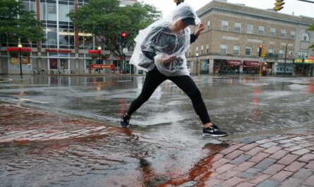
The flooding was triggered by intense thunderstorms that dropped over six inches of rain on Chattanooga — the city’s second-wettest day ever recorded.
Victims Include Missing Man and Family in East Ridge
Chattanooga fire crews confirmed Wednesday that they recovered a body matching the description of a man who went missing after being swept away on East Brainerd Road during the height of the storm.
Mayor Tim Kelly said the man was attempting to drive around fire department barricades when he was caught in fast-moving floodwaters.
“Unfortunately, [he] unwisely tried to maneuver around barricades and was swept away by a stream,” Kelly said.
According to Fox Weather, In a separate tragedy, saturated ground caused a large tree to fall onto a car in East Ridge, killing two adults and a child. The Hamilton County Office of Emergency Management and Homeland Security confirmed the fatalities occurred early Wednesday morning on South Moore Road.
Emergency Declarations and Widespread Rescues
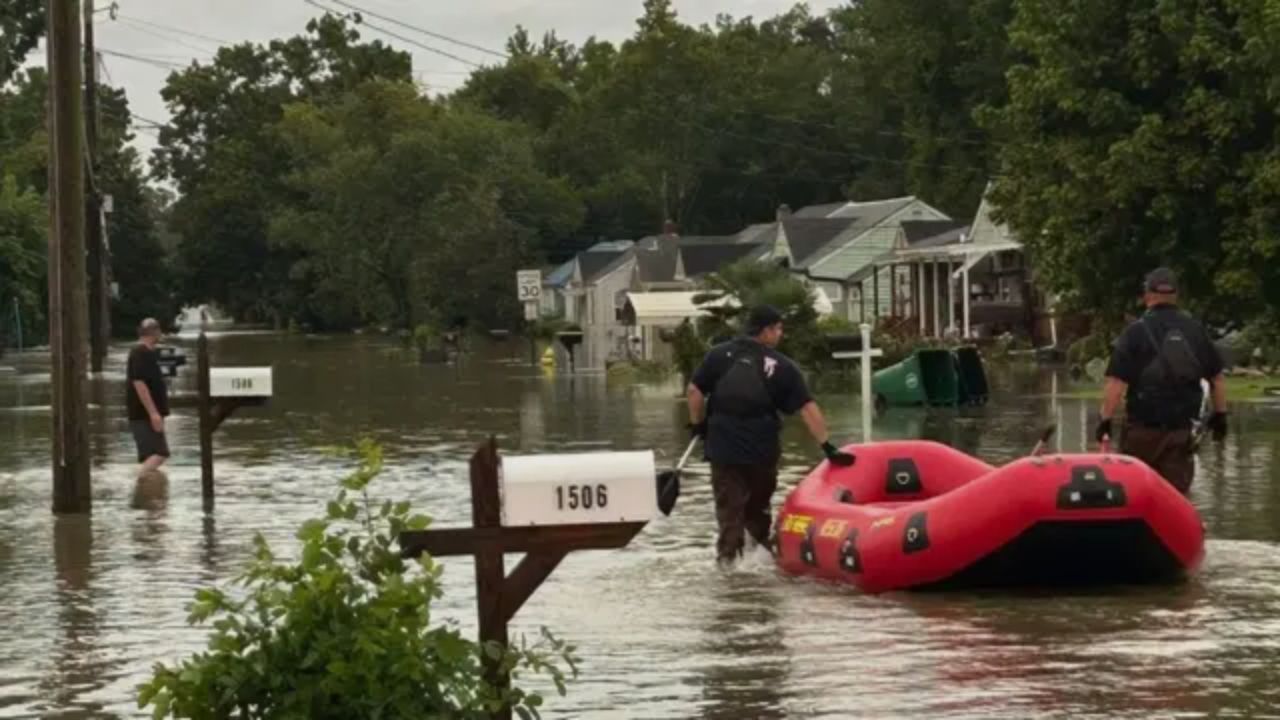
Hamilton County Mayor Weston Wamp declared a state of emergency Tuesday evening as rescue teams worked through the night. Swift water crews conducted 35 rescues, including pulling stranded drivers from vehicles and helping residents trapped inside homes.
One of the hardest-hit areas was along Interstate 24 southeast of Chattanooga, where floodwaters several feet deep forced the closure of the highway in both directions. Dozens of other roads across Hamilton County were also submerged.
At least one storm shelter was opened at a local recreation center to house residents displaced by the rising waters.
Record-Breaking Rainfall and Road Hazards
The National Weather Service (NWS) reported that 6.08 inches of rain fell on Chattanooga Tuesday, making it the second-highest daily total in city history. The downpour was fueled by storms ahead of a cold front moving through the Southeast.
The NWS issued a Flash Flood Warning during the event, reminding residents:
“Turn around, don’t drown when encountering flooded roads. Most flood deaths occur in vehicles. Move to higher ground now. Act quickly to protect your life.”
First responders stressed that just six inches of moving water can knock an adult off their feet, while a foot of floodwater can stall most vehicles and potentially sweep them away.
Recovery Efforts Underway
On Wednesday, Mayor Wamp toured flood-damaged areas with emergency officials and East Ridge first responders to assess the situation. Recovery priorities include clearing debris, repairing damaged infrastructure, and supporting families affected by the flooding.
The cold front responsible for the deluge will linger into Thursday, bringing another round of scattered showers and storms before conditions improve.
Once the rain moves out, forecasters expect highs in the 90s with heat indexes approaching 100 degrees — adding another challenge for cleanup crews and residents without power or air conditioning.
Safety Reminders
Authorities urge residents to remain vigilant, even as waters recede. Hidden hazards, weakened roadbeds, and downed power lines may remain in flood-affected areas.
Key safety tips from emergency officials include:
- Avoid driving on flooded roads, especially at night when water depth is harder to see.
- Stay away from downed electrical lines and report them to utility providers.
- Watch for sudden rises in water levels during additional rainfall.
- Check on vulnerable neighbors and elderly residents during extreme heat following the storms.
Chattanooga’s historic flooding serves as a stark reminder of the dangers posed by flash floods, even in familiar neighborhoods. With additional rain possible and dangerous heat ahead, emergency officials are urging residents to remain cautious and prepared.
How has the recent severe weather impacted your area? Share your experience in the comments at ibwhsmag.com.