 by
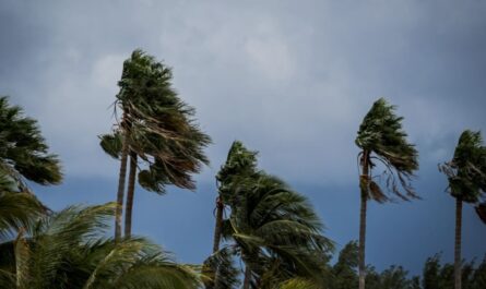
by New York City, NY – Residents across New York, New Jersey, and the broader Northeast may be in for their first significant snowfall of the season this weekend, as forecasters track a developing weather system fueled by cold air from the Polar Vortex. Meteorologists say the setup could create prime snow-making conditions, with accumulating snow possible by Sunday.
When Will Snow Start in New York and the Northeast?
Forecasters at the FOX Forecast Center say a storm system is expected to take shape as cold air from the Polar Vortex pushes southward into the U.S.
As of Thursday, meteorologists reported that snow is expected to move through parts of the Midwest on Saturday, before shifting east into the Northeast on Sunday. This timeline places New York City, New Jersey, and the tri-state area in the potential impact zone by the end of the weekend.
While snowfall may begin early Sunday in some areas, officials caution that timing and intensity will depend on how much cold air and moisture ultimately combine over the region.
What Is the Polar Vortex and Why Does It Matter?
The Polar Vortex is a large area of low pressure and extremely cold air that typically circulates around the Earth’s poles. When it remains strong, the cold air stays locked far north. However, when the Polar Vortex weakens, that frigid air can spill southward into the United States.
Experts say that’s exactly what could happen this weekend. According to forecasters, the southward leak of cold air will collide with moisture moving north, creating what they describe as “prime snow-making conditions” across both the Midwest and Northeast.
This interaction raises the possibility of a low-pressure system forming over the Northeast, which could significantly increase snowfall potential.
How Much Snow Could Fall?
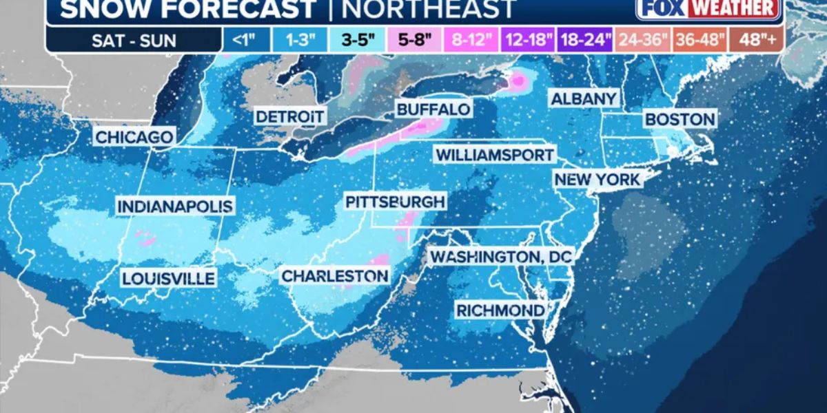
According to the National Weather Service, New York City has nearly a 20% chance of seeing two inches or more of snow by Sunday. While that may not sound dramatic, it would mark the most impactful snowfall of the season so far for the city.
Snow totals are expected to vary by location:
- West New Jersey could see totals as high as four inches
- The tri-state area, including New York City, may see between 0.5 inches and 1 inch
- Higher elevations and inland areas could receive slightly higher amounts, depending on storm development
Forecasters stress that snowfall totals could still change depending on how the system evolves.
Key Factors That Could Increase Snowfall
Meteorologists say two main ingredients will determine whether the Northeast sees a light dusting or a more significant snow event:
- Cold air strength moving south from the Polar Vortex
- Moisture availability from the southern atmosphere
If these elements align at the right time, a stronger storm system could form, increasing the chances of heavier snowfall across New York and New Jersey.
How Cold Will It Feel?
Even if snowfall totals remain modest, residents should prepare for bitterly cold conditions.
As of Thursday, FOX Weather predicted a 64% chance of snow Sunday morning, with actual temperatures expected to be in the 30s. However, due to strong winds and cold air, it could feel closer to 17 degrees, making it one of the coldest weekends of the season so far.
Officials warn that wind chills could create hazardous conditions for anyone spending extended time outdoors.
What Residents Should Do Now
With winter weather potentially returning in force, officials encourage residents to take simple precautions:
- Monitor local forecasts and alerts
- Allow extra travel time on Sunday
- Dress in warm layers to protect against dangerous wind chills
- Check heating systems and winter supplies ahead of time
Even light snow combined with cold temperatures can create slick roads and sidewalks, especially early in the season when drivers and pedestrians may not yet be fully adjusted.
Looking Ahead
Forecasters say this system could set the tone for a more active winter pattern across the Northeast. While it may not be a blockbuster storm, it could be the first reminder that winter weather is officially back.
Meteorologists will continue refining snowfall predictions as the weekend approaches.
What Do You Think?
Are you ready for the first snow of the season, or hoping winter holds off a little longer? How much snow do you think your area will see this weekend? Share your thoughts and local conditions in the comments below.