 by
by Trenton, NJ – New Jersey residents should prepare for a quick-hitting winter storm this weekend as forecasters increase snowfall projections across the state. According to the National Weather Service, widespread snow totals of 1 to 4 inches are now expected, followed by bitterly cold temperatures and dangerous wind chills that could drop into the single digits and near zero in some areas.
When Will Snow Begin in New Jersey?
Meteorologists say snow will begin Saturday night and continue into Sunday morning, impacting overnight travel and early Sunday activities.
The National Weather Service noted that precipitation may start as light rain or a rain/snow mix, particularly south and east of Interstate 95, before quickly transitioning to all snow as colder air rushes in.
“Snowfall intensity may increase for a time early Sunday morning,” forecasters said, adding that conditions could change rapidly overnight.
The steadiest snowfall is expected between midnight and sunrise Sunday, making road conditions potentially hazardous during the overnight and early morning hours.
How Much Snow Is Expected?
Snow totals will vary by region, but forecasters agree this system could deliver the most widespread snow New Jersey has seen in weeks.
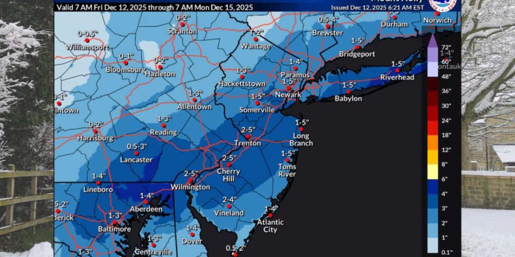
Projected snowfall totals include:
- 2 to 4 inches along and south of Interstate 95, including the Jersey Shore and southern New Jersey
- 1 to 2 inches across northern and northwestern New Jersey
- AccuWeather predicts 1 to 3 inches statewide
Some coastal communities may briefly experience a wintry mix at the onset of the storm before changing over to all snow.
Meteorologists caution that small changes in storm speed could still alter totals, especially along the coast and in higher elevations.
Snow Ends, Arctic Front Brings Brutal Cold
Snow is expected to taper off from west to east between late Sunday morning and early afternoon as an Arctic front sweeps through the region.
Behind the front, conditions will turn dangerously cold and windy.
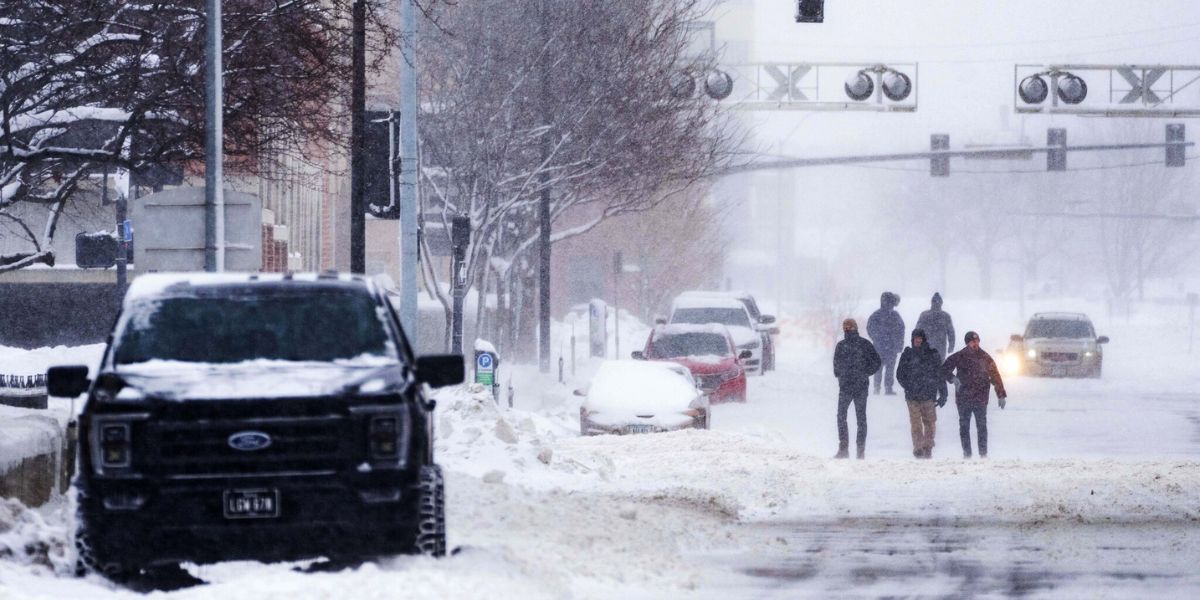
Forecasters warn that Sunday afternoon winds will increase, with gusts reaching 25 to 30 mph, creating blowing snow and significantly reduced visibility, especially in open and rural areas.
Wind Chills Drop Into Single Digits, Near Zero
By Sunday night, temperatures will plunge across the state.
- Wind chills are expected to fall into the single digits statewide
- Northern New Jersey could see wind chills near zero
- Overnight lows will drop into the teens, with some far northern areas near 10 degrees
“The coldest time frame is Sunday night through Monday night,” the weather service warned.
Monday Remains Below Freezing Statewide
The cold snap will continue into Monday, with high temperatures remaining below freezing for nearly the entire state.
Gusty winds of 20 to 25 mph will persist, making it feel even colder throughout the day. Officials urge residents to limit prolonged outdoor exposure and check on elderly neighbors and pets.
Gradual Warm-Up, Then Major Pattern Change
Conditions begin to moderate on Tuesday, though it will remain cold with lighter winds.
By Wednesday, temperatures will slowly increase but still remain below seasonal averages.
A significant pattern change arrives on Thursday, when much milder air is expected to push temperatures into the 50s across much of New Jersey—a dramatic shift after the weekend cold.
Forecasters say rain is possible Thursday, particularly during the afternoon and evening hours, which could help wash away lingering snow and ice.
What Residents Should Do Now
With snow, wind, and extreme cold ahead, officials recommend:
- Avoiding unnecessary travel overnight Saturday into Sunday
- Allowing extra time for Sunday morning travel
- Dressing in layers to protect against dangerous wind chills
- Preparing homes, pets, and vehicles for sub-freezing temperatures
Even a few inches of snow combined with strong winds can create treacherous driving conditions, especially during early winter storms.
What Do You Think?
Are you ready for New Jersey’s weekend winter storm, or hoping snowfall stays on the lower end? How much snow are you expecting where you live? Share your thoughts and local conditions in the comments below.