 by
by California – After a breezy and cooler weekend, the Golden State is bracing for a major weather shift. The National Weather Service (NWS) warns that the most significant heat wave of the summer season will arrive by midweek, bringing with it triple-digit heat, warm nights, and the potential for monsoon thunderstorms.
The heat is forecast to peak between Thursday and Saturday, with some inland areas possibly seeing record-breaking temperatures. Meanwhile, subtropical moisture from the North American Monsoon will increase the chances of thunderstorms and raise the risk of wildfire ignitions from dry lightning, particularly in Southern California and the Sierra Nevada.
Slow Warm-Up, Then Intense Heat
California will see a gradual warm-up early in the week before the heat intensifies. On Monday, a lingering area of low pressure off the coast will keep temperatures slightly below normal, but the pattern quickly changes starting Tuesday.
By Wednesday, a strong high-pressure system that fueled hot weather in the eastern U.S. will shift westward, setting the stage for a prolonged heat wave across California. The NWS warns that:
- Triple-digit highs are likely in the San Joaquin Valley, Mojave Desert, and Inland Empire.
- Bay Area cities like Walnut Creek, Concord, Santa Rosa, and Livermore could hit 100°F on Thursday and Friday.
- Lake Tahoe is expected to see highs in the mid-80s to low 90s, well above seasonal averages.
Even overnight, the relief may be minimal. Lows in the Central Valley may not drop below 70°F between Thursday and Sunday — potentially breaking record warm nighttime temperatures.
Coastal California Stays Relatively Cool
Unlike inland areas, San Francisco and Oakland are not expected to see the same extreme heat thanks to cool marine breezes. However, even the coast will warm compared to recent weeks:
- San Francisco could see highs in the 70s.
- Oakland may reach the 80s at least once during the peak of the heat wave.
- San Jose and Los Angeles are forecast to hit the 90s on Thursday and Friday.
This inland-coastal contrast is typical during August heat waves, where marine layers shield the Bay Area but leave nearby valleys baking.
Monsoon Thunderstorms Add Fire Risk
Heat isn’t the only concern. Moisture from the North American Monsoon will rotate into California midweek, increasing the chances of thunderstorms in the mountains.
Starting Wednesday, storms could develop in:
- The San Diego County Mountains
- The Ventura and San Gabriel Mountains
- The Antelope Valley and southern Sierra Nevada
By Friday and Saturday, the storm chances may expand northward toward the Lake Tahoe basin.
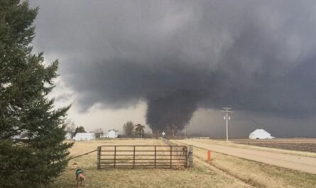
These storms are expected to produce a mix of wet and dry lightning. While rain may dampen some areas, dry lightning strikes on parched vegetation could ignite wildfires quickly, prompting the NWS to issue a Fire Weather Watch for parts of Southern California.
According to SF Chronicle, Even areas without storms will feel the effect of the monsoon moisture. High humidity will trap heat overnight, leading to record warm lows in the Sierra Nevada and Central Valley.
Outlook Beyond the Weekend
Forecasters remain uncertain whether the heat wave will persist beyond Sunday, but at least four consecutive days of extreme heat and elevated wildfire risk are expected across interior California.
Meteorologists emphasize that while this event is typical of late-summer weather patterns, the combination of dangerous heat, warm nights, and thunderstorms could challenge residents and emergency responders alike.
Key Takeaways for Californians
- Heat Peaks Thursday–Saturday: Expect triple-digit highs inland and possible records in the San Joaquin Valley and Mojave Desert.
- Warm Nights Ahead: Some areas may see overnight lows stay above 70°F, threatening heat records.
- Coastal Cities Stay Cooler: San Francisco and Oakland will avoid the worst but still see warmer-than-normal days.
- Thunderstorms Raise Fire Risk: Dry lightning in Southern California mountains and possibly Tahoe could spark new wildfires.
- Stay Alert: NWS forecasts may adjust timing and storm intensity as the week progresses.
Safety Reminder: Stay hydrated, avoid strenuous outdoor activity during peak heat, and pay close attention to fire weather alerts.
Do you think California is prepared for simultaneous heat waves and wildfire threats? Share your thoughts with us at ibwhsmag.com.