 by
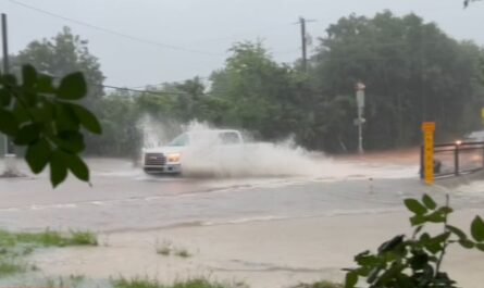
by Typically dry in September, Southern California and neighboring areas like Arizona and the lower Colorado River Basin are now facing renewed heavy rain and possible flooding from Monday through Wednesday of this week. Experts warn that the risk of flash flooding is especially high on Tuesday and Wednesday, posing serious challenges for communities still reeling from last week’s storms.
Understanding the Unusual Weather Pattern
The FOX Forecast Center has identified that an unusual cutoff low-pressure system has developed in the upper atmosphere off Southern California’s coast. This system is unique in that it has detached from the usual west-to-east jet stream flow, becoming stalled and causing prolonged precipitation over the region.
Adding to the rainfall intensity, this stalled system is actively drawing in tropical moisture from the remnants of another Pacific tropical storm, Tropical Storm Narda. This combination mimics the conditions seen last week when the remnants of Tropical Storm Mario delivered a significant surge of moisture and heavy rain.
- Cutoff low means weather patterns become stationary, increasing precipitation.
- Tropical moisture from Storm Narda enhances storm rainfall.
- An extended period of rain is expected to last several days this week.
Impact of Previous Flooding and Current Risks
Last week’s storm system caused catastrophic flash flooding in the San Bernardino mountains, particularly in hilly terrains where debris flows are common during heavy rains. The floodwaters tragically claimed the life of a 2-year-old boy in Barstow, California, after a car was swept away by raging waters. Rescue efforts saved the boy’s father, who was later found stranded on an island created by floodwaters.
The San Bernardino County Fire Department reported mudslides and debris flows causing multiple road closures and stranding at least ten people on California State Route 38. Homes and roads in areas like Forest Falls, Oak Glen, and Potato Canyon were also severely affected by the flooding and landslides.
“Mudslides and debris flows have significantly impacted our communities, stranding residents and damaging infrastructure,” said a representative from the San Bernardino County Fire Department.
Forecast and Safety Recommendations
The FOX Forecast Center forecasts lighter rain on Monday, with rainfall intensity increasing on Tuesday. An additional quarter- to half-inch of rain is expected on soil that remains saturated from previous storms, raising the threat of flash flooding.
Read Also: Chance of Rain and Storms Increases Across Maryland This Week
NOAA’s Weather Prediction Center has issued a Level 1 out of 4 flash flood risk for the California coast stretching from San Jose down to Santa Barbara for Tuesday. This risk area will expand inland on Wednesday, reaching the Nevada border and parts of Los Angeles.
- San Diego recorded 0.45 inches of rain from the earlier event, exceeding its average September monthly rainfall of 0.13 inches.
- This recent rain event marks San Diego’s seventh-wettest September on record.
- Residents are urged to monitor weather updates and avoid flood-prone areas.
For more detailed weather updates and safety advice, visit the official FOX Weather report here.
Preparing for What’s Ahead
With the ground still saturated and the weather system stalled, communities in Southern California and neighboring regions should remain vigilant. Emergency services are on alert, and residents should follow local advisories closely.
Key steps to prepare for potential flooding include:
- Avoid driving through flooded roads or low-water crossings.
- Keep emergency supplies ready, including food, water, and medications.
- Stay tuned to local news and weather alerts for changing conditions.
Stay informed and prioritize safety during this rare September rain event.
What do you think about this rare September rain in Southern California? Have you been affected by the recent flash floods? Share your experiences and opinions in the comments below!