 by
by Fort Smith, AR – A significant severe weather event is unfolding across the southern Plains, threatening nine states with damaging storms, particularly in parts of Oklahoma and Arkansas. Forecasters warn that some areas could experience strong tornadoes, large hail, damaging winds, and flash flooding as the storm system moves through the region Tuesday into Wednesday.
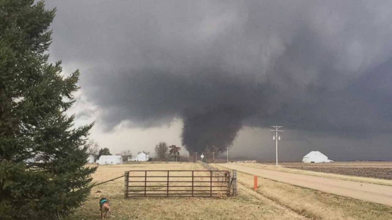
The National Oceanic and Atmospheric Administration’s (NOAA) Storm Prediction Center (SPC) has highlighted northeastern Oklahoma and northwestern Arkansas as the highest risk zones for strong supercell thunderstorms capable of producing tornadoes rated EF-2 or greater. This severe weather threat extends into the Mississippi and Tennessee valleys, compounding concerns as fall ushers in a secondary peak in severe weather activity across the central U.S.
The Emerging Severe Weather Threat across the Southern Plains
On Tuesday afternoon, powerful thunderstorms are expected to develop along a cold front stretching through eastern Oklahoma and western Arkansas. The SPC has issued a Level 3 out of 5 risk for severe thunderstorms in these critical areas, including urban centers like Fort Smith and Little Rock in Arkansas.
Additional regions stretching from North Texas and the Dallas-Fort Worth Metroplex are under Level 2 severe weather risk, which includes threats from:
- Large hail exceeding 2 inches in diameter
- Damaging wind gusts expected to persist through overnight hours
- Potential for repeated rounds of thunderstorms lasting into Wednesday
This surge in severe weather coincides with the start of the fall season, traditionally recognized as the region’s second severe weather season. Residents in these communities are urged to remain vigilant.
Heightened Tornado and Hail Risks in Oklahoma and Arkansas
The greatest tornado risk is concentrated in northeastern Oklahoma and northwestern Arkansas, where supercell storms may produce tornadoes with intensity EF-2 or stronger.
An estimated 2.1 million people live in areas where hail larger than 2 inches could fall, with major cities such as Tulsa, Fayetteville, and Fort Smith specifically at risk.
“The approaching storm system interacts with a dip in the jet stream to create favorable conditions for severe weather,” said a NOAA weather expert. “Residents in these regions should prepare for the possibility of tornadoes and damaging hail this evening.”
Flash Flooding Threats and Extended Rainfall
Besides tornadoes and hail, the storm system brings a significant threat of flash flooding. Forecasters predict:
- 3 to 5 inches of rainfall possible from Oklahoma through East Tennessee by Thursday
- Localized pockets potentially receiving 5 to 8 inches of precipitation
- Flood Watches currently covering over 5 million people across eastern Kansas, Oklahoma, southwestern Missouri, and northwestern Arkansas
These persistent storms heighten the risk for rapid flooding and water-related damage overnight and into midweek.
For full details and ongoing updates on this developing situation, visit the Fox Weather report.
Preparing for Impact: Safety and Awareness
With the potential for severe tornadoes, large hail, damaging winds, and flash floods over a broad area, residents across the southern Plains should:
- Monitor local weather alerts and warnings continuously
- Have a safe shelter plan in case of tornado warnings
- Avoid driving through flooded roadways and remain cautious during heavy rainfall
- Secure outdoor objects that may become projectiles in strong winds
Early preparation and awareness remain key to minimizing risks during this active fall weather period.
What do you think about the approaching severe weather threat? How are you preparing for possible tornadoes or flooding? Share your experiences and safety tips in the comments below!