 by
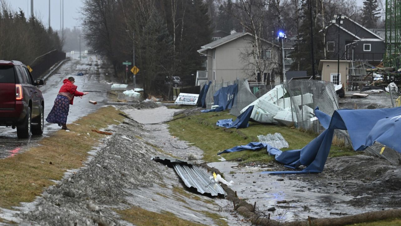
by Anchorage, AK – The National Weather Service (NWS) in Anchorage has issued a critical Hurricane Force Wind Warning for sections of the Northern Gulf of Alaska, with particularly severe impacts expected near the Barren Islands, Kodiak Island, and the Cook Inlet region this Wednesday.
Residents, mariners, and offshore operators are bracing for rapidly intensifying winds and dangerously high seas, heralding one of the most significant weather events to hit this part of Alaska in recent memory.
Rapidly Escalating Winds and Hazardous Sea Conditions
The NWS Coastal Waters Forecast indicates that starting Wednesday morning, sustained winds will climb swiftly to 55 knots, with speeds escalating up to 65 knots by afternoon. Sea heights are predicted to surge from 18 feet to 24 feet, generating perilous conditions across coastal and offshore waters.
- Winds: Expected to reach hurricane-force levels at 65 knots during peak hours.
- Seas: Rising dramatically, making navigation and marine operations extremely risky.
- Duration: Hazardous conditions will span Wednesday and gradually subside Thursday.
“These conditions pose a serious threat to marine safety, with potential for damage to smaller craft and difficulty maintaining course in open waters,” warns the NWS Anchorage office. Mariners are strongly advised to avoid travel and ensure all vessels are secured in safe harbor prior to the storm’s arrival.
Impact on Local Marine Activities and Safety Precautions
The storm system will persist through Wednesday night with winds tapering off to around 40 knots, but dangerously high seas will linger through Thursday. This ongoing threat emphasizes the need for heightened vigilance among fishermen, recreational boaters, and shipping operators.
Read Also: Halloween Chaos: Chicago Police Arrest Three During Children’s Costume Parade
Key safety recommendations include:
- Securing all vessels in sheltered areas ahead of the storm.
- Postponing travel plans on affected waters until conditions improve.
- Monitoring updates continuously via the official NWS website.
Stay Informed with Trusted Weather Updates
For the latest marine forecasts and detailed weather updates, visit the National Weather Service Anchorage page at weather.gov/Anchorage. Staying informed is crucial to ensuring personal and vessel safety during this severe coastal weather event.
What This Means for the Community and Mariners
The approach of hurricane-force winds near the Barren Islands marks a significant marine weather hazard for the Alaska coastal region. The heightened risk impacts commercial fishing fleets, transport vessels, and local residents alike.
“Preparation and caution are essential to mitigate the risks posed by this rapidly developing storm,” NWS experts emphasize.
Summary of Critical Facts
- When: Wednesday, with weakening conditions continuing into Thursday
- Where: Northern Gulf of Alaska, including the Barren Islands, Kodiak Island, and Cook Inlet
- Wind Speeds: Up to 65 knots (hurricane force)
- Sea Heights: Increasing up to 24 feet
What do you think about this coastal alert and its impact on Alaska’s marine activities? Share your thoughts in the comments below!