 by
by Chicago, Illinois – A dramatic shift in weather is on the way for much of the United States this week, bringing fall-like temperatures to over 200 million people across the central and eastern regions. While the western U.S. continues to battle dangerous heat, a cold front moving down from Canada will usher in a much cooler air mass, creating what experts say will feel like an early taste of autumn.
Heat in the West, Cool Air in the East
According to the FOX Forecast Center, the nation will experience a “tale of two forecasts.” The western half of the country will endure an ongoing late-summer heat wave through Monday, while a sharp cold front sweeps through the northern Plains, Great Lakes, and eventually the Northeast.
Already on Sunday, nearly 100 million Americans felt below-average temperatures across the northern Plains and the upper Mississippi Valley. Minneapolis, for example, struggled to reach even 60 degrees by mid-morning.
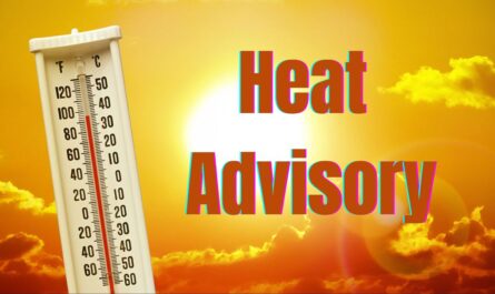
Meanwhile, much of the West, from California to Arizona, remains under heat alerts, with daytime highs pushing into the triple digits.
Temperatures Plunge in the Midwest and Great Lakes
As the Canadian low-pressure system pushes southward, temperatures in the Great Lakes and Midwest are expected to plummet. Forecasts show morning lows dipping into the 40s, and parts of northern Minnesota may even see temperatures in the 30s, triggering a Frost Advisory from International Falls to West Cook.
By Tuesday, major cities like Oklahoma City may not even hit 70 degrees, with readings across the central and southern Plains dropping as much as 20 degrees below average for late August.
A Chilly Start for the Northeast
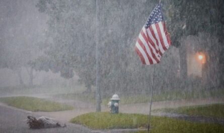
The cold front will bring more than just cooler air—it will also be accompanied by showers across the Northeast to start the week. While the rain may dampen commutes on Monday, residents will notice the crisp, fall-like feel by Tuesday and Wednesday.
The NOAA Climate Prediction Center warns that record-cold high temperatures are possible midweek in some areas. These cooler-than-normal readings are expected to linger through the end of August and into early September.
Read Also: Seattle Braces for Heat Wave With Near 90-Degree Weekend, Heat Advisory Issued
Timing Aligns With Start of Meteorological Fall
This dramatic cooldown comes just in time for the arrival of meteorological fall on September 1, though astronomical fall does not officially begin until September 22. For many, it means pumpkin spice lattes and hoodies will arrive earlier than expected this year.
The contrast is striking: while 200 million residents east of the Rockies prepare for sweater weather, those out West will still be blasting air conditioning to cope with intense late-summer heat.
What Residents Should Expect
- Midwest & Great Lakes: Temperatures dropping into the 40s and 50s, with the chance of record-breaking cold highs midweek.
- Northern Plains: Morning lows in the 30s, with frost advisories in effect.
- Northeast: Showers followed by crisp, fall-like conditions starting Tuesday.
- Central & Southern Plains: Highs nearly 20 degrees below average, including Oklahoma City barely reaching the 70s.
- Western U.S.: Ongoing heat alerts, with temperatures soaring well above average.
Looking Ahead
This shift signals that the seasonal transition is near. According to NOAA’s long-range outlook, the cooler-than-average trend will likely extend into the first week of September, giving much of the eastern U.S. an extended break from the summer heat.
Meanwhile, the West will continue to grapple with high temperatures that fuel wildfire concerns and strain energy resources.
For millions of Americans, this week will bring the first true reminder that summer is winding down—and that autumn is knocking on the door.
Share Your Thoughts
Are you welcoming the fall-like cooldown, or are you still holding on to summer heat? Share your thoughts in the comments below. For more local and national weather updates, visit ibwhsmag.com.