 by
by Baton Rouge, Louisiana – Residents across south Louisiana and parts of Mississippi are being urged to prepare for a significant drop in temperatures as cold Arctic air moves into the region, setting the stage for a widespread freeze overnight and into early Monday morning. Meteorologists warn that dangerous conditions could pose risks to people, pets, and property if precautions are not taken.
First Alert: Cold Weather Advisory in Effect
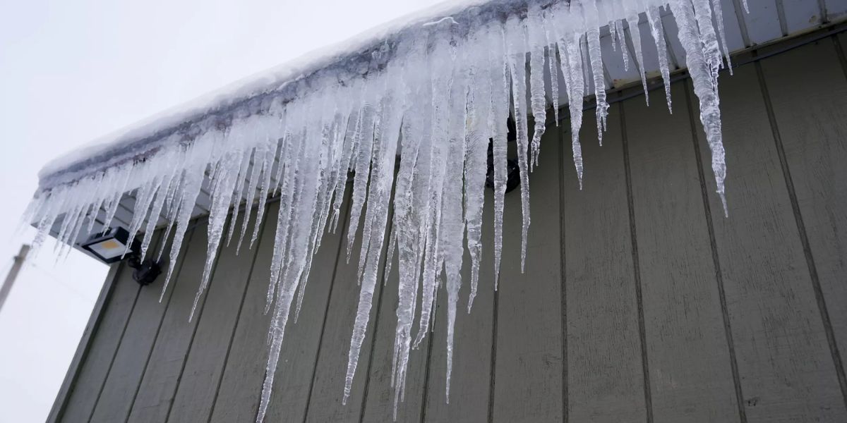
A Cold Weather Advisory remains active as forecasters anticipate dangerously low wind chills across the region. Officials say wind chill values are expected to fall into the teens and low 20s, making it feel significantly colder than the actual air temperature.
Surface temperatures are projected to range from the mid-20s to the low 30s, with the coldest readings likely occurring during the overnight and early morning hours. Areas north of the I-10/12 corridor face the highest risk, where temperatures could dip to 25 degrees or lower, increasing the likelihood of a hard freeze.
Residents are encouraged to complete all cold-weather preparations immediately, especially by protecting the “four Ps” — people, pets, plants, and pipes. Exposed plumbing should be insulated, outdoor plants covered, pets brought indoors, and vulnerable individuals kept warm and safe.
Frigid Conditions Expected on Monday
The cold won’t end once the sun rises. Forecasters say Monday will remain unseasonably chilly due to lingering Arctic air across the region. Daytime highs are expected to stay in the 40s for most inland locations, with only a few areas near the coast possibly reaching the low 50s.
Officials advise residents to dress in layers, limit prolonged outdoor exposure, and use space heaters safely to avoid fire hazards. The sharp contrast between daytime highs and overnight lows may catch some residents off guard, particularly those unaccustomed to extended cold spells in Louisiana.
Another Freeze Possible Tuesday Morning
Although the cold snap is temporary, another round of freezing conditions is expected early Tuesday morning. Meteorologists warn that a light freeze and widespread frost could develop, particularly in rural and low-lying areas.
Gardeners and homeowners are advised to keep protective coverings in place and continue monitoring local weather updates. Even brief freezing conditions can cause damage to sensitive plants and exposed pipes.
Warming Trend on the Horizon
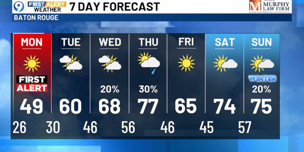
There is good news ahead. Forecasters say the Arctic air mass will begin retreating by the middle of the week, allowing milder temperatures to return. As winds shift and warmer air moves in, daytime highs are expected to steadily climb.
By Thursday, temperatures could rebound into the 70s, offering a dramatic turnaround from the early-week chill. Meteorologists note that this warming trend may persist into next week, bringing above-normal temperatures across much of the region.
Seven-Day Forecast Brings Relief
The seven-day outlook suggests that while cold weather will dominate the start of the week, it will be short-lived. After Tuesday’s frost risk, conditions are expected to steadily improve, providing a welcome return to more typical winter weather for Louisiana.
Officials continue to emphasize staying weather-aware and taking cold precautions seriously until temperatures rise consistently.
What do you think about this sudden cold snap? Are you prepared for freezing temperatures in Louisiana? Share your thoughts and experiences in the comments below and join the conversation.