 by
by Houston, TX – Residents of Southeast Texas are experiencing a mix of warm winds, fog, and an incoming cold front that promises to bring rain and cooler temperatures over the next few days. While Saturday’s mild conditions may feel more like early spring than winter, the region will see a brief cold snap before temperatures rebound later in the week.
Fog and Warm Winds Set the Stage for Saturday
Ahead of the approaching cold front, warm onshore winds are bringing another round of fog to the Houston area early Saturday morning, officials say. Visibility is expected to improve by 10 a.m., giving way to partly to mostly cloudy skies throughout the day.
While sunshine may be muted, daytime temperatures will remain well above seasonal averages, reaching the mid to upper 70s, providing residents a mild and comfortable day before the next system moves in.
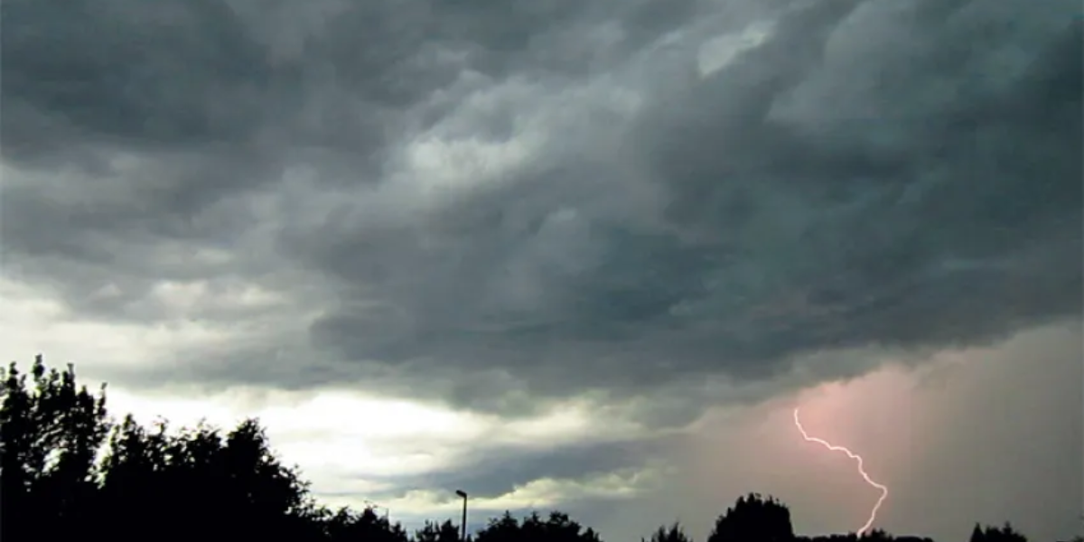
Rain Moves In with Cold Front Saturday Night
As the cold front pushes through Saturday night into Sunday morning, meteorologists forecast a chance of rain, beginning Saturday evening and tapering off by late Sunday morning. Rain amounts are expected to be moderate, enough to create slick roads in some areas.
Once the precipitation ends, cloud cover will decrease, and a dry, cold north wind will usher in a more winter-like feel.
Sunday Temperatures Drop, Winter Feel Returns
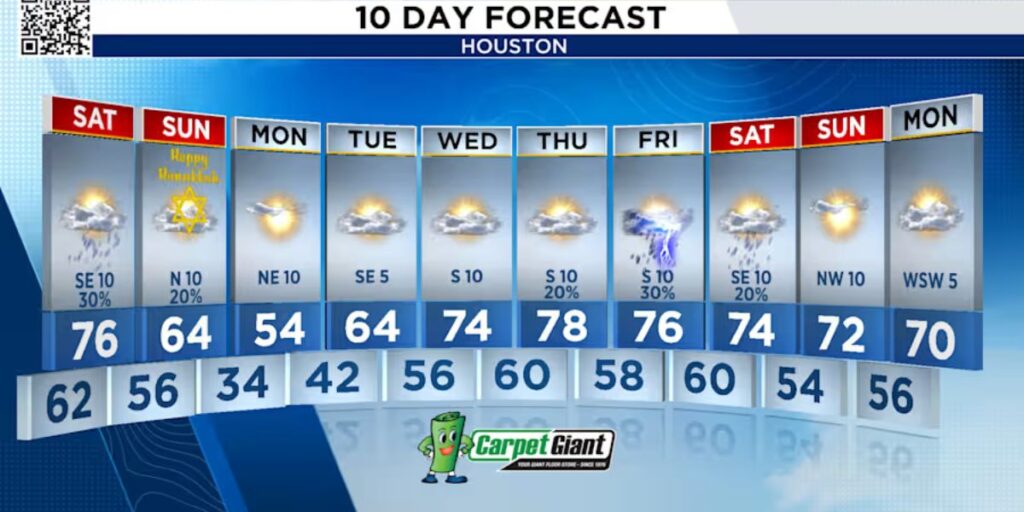
Despite a forecasted high in the mid-60s on Sunday, the cold north wind will make conditions feel much chillier. Early morning temperatures will begin in the mid-60s, but the persistent wind will reinforce the wintry conditions, reminding Houstonians that winter is still present.
Meteorologists emphasize that while daytime highs may seem moderate, wind chill and gusts will make it feel significantly colder.
Monday Brings Morning Frost and 30s Temperatures
Residents should prepare for Monday morning lows in the 30s, marking the brief height of this short-lived cold snap. The drop in temperatures will likely affect early morning routines, including commuting and outdoor activities, as frost and cold surfaces develop.
Despite the chilly start, daytime highs will rebound, warming back into the 60s and 40s by Tuesday, giving Houston a quick return to more comfortable conditions.
Midweek Warm-Up Returns to the 70s
Following the cold snap, temperatures will steadily rise, returning to the 70s by midweek. Sunshine will increase, and residents can expect pleasant, mild conditions after a brief taste of winter.
Meteorologists advise locals to dress in layers over the next few days, particularly for early morning and evening activities, as the fluctuation between warm and cold temperatures may catch some off guard.
Key Takeaways for the Week
- Saturday: Fog early, clearing by 10 a.m., partly to mostly cloudy, highs in mid to upper 70s
- Saturday night – Sunday morning: Cold front brings rain, tapering late Sunday morning
- Sunday: Dry, cold north wind; highs in mid-60s, feel like winter
- Monday morning: Lows in the 30s, short-lived cold snap
- Tuesday–Wednesday: Temperatures rebound, highs return to the 70s
How are you preparing for Houston’s quick swings between warm and cold weather this week? Comment below with your tips for staying comfortable and safe during sudden temperature changes, rain, and chilly winds.