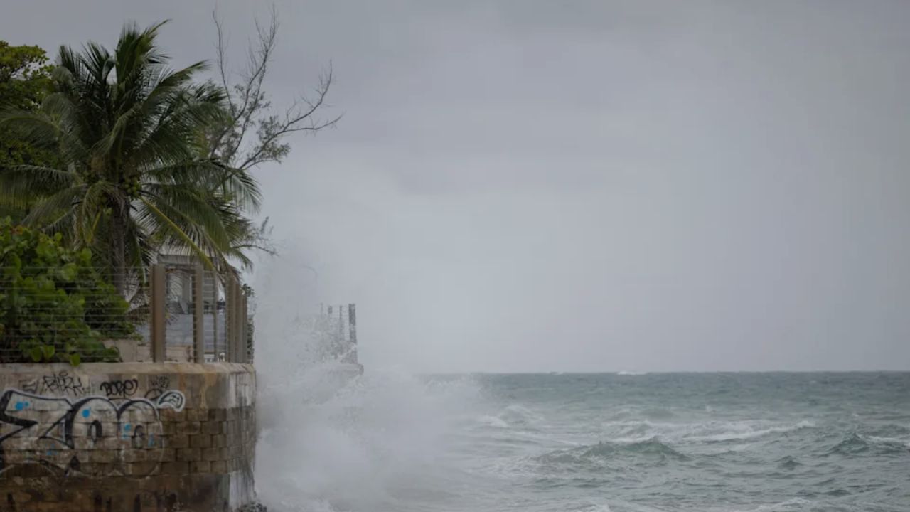
Hartford, CT – As Hurricane Erin continues to strengthen in the Atlantic, Connecticut is preparing for indirect impacts that could affect the shoreline and nearby waters throughout the week. While the state is not expected to see a direct landfall, forecasters warn that increased surf, larger waves, and dangerous rip currents may affect Long Island Sound and surrounding areas.
Surf and Rip Current Concerns Along the Shoreline
According to Joseph Villani, meteorologist with the National Weather Service (NWS) in Albany, Connecticut’s shoreline can expect “bigger surf than normal” as Erin churns offshore.
The National Hurricane Center (NHC) has issued warnings that the storm could generate life-threatening surf and rip currents along much of the East Coast over the next several days.
Fortunately, Long Island provides Connecticut with a natural buffer, reducing the storm’s direct impacts compared to states with more exposed Atlantic coastlines. Still, forecasters caution that residents and visitors should remain vigilant near the water, especially in eastern parts of Long Island Sound, where conditions may be more severe.
Small Craft Advisory in Effect
Boaters are being urged to exercise extreme caution. The NWS has issued a small craft advisory for Long Island Sound, with offshore winds expected to increase up to 20 knots and gusts potentially reaching 30 knots.
These conditions, combined with rougher waters, could pose serious risks for smaller vessels. “Impacts are expected to be greater east of the Connecticut River,” Villani noted.
Areas Most at Risk
While Connecticut’s inland towns are unlikely to feel much from Erin, certain coastal regions could see stronger effects. Block Island, Rhode Island’s coast, and Long Island’s southern shoreline are forecast to take the brunt of the storm’s waves and swells, according to reports from WFSB.
For Connecticut, the highest risk zones remain eastern Long Island Sound and shoreline communities east of New Haven.
A Refreshing Temperature Shift
According to Patch, In contrast to the looming hurricane threat, much of Connecticut is currently experiencing refreshingly cool weather following the passage of a cold front. Residents have noted milder conditions with comfortable highs in the mid-to-upper 70s, a noticeable relief compared to recent summer heat.
Meteorologists expect these moderate temperatures to persist through much of the week, providing a silver lining as the state monitors Hurricane Erin’s offshore track.
Read Also: California Heat Wave and Monsoon Storms: What to Expect This Week
Forecast for Southern Connecticut (via NWS)
- Tuesday: Mostly sunny, high near 75. Winds NE 8–11 mph, shifting SE in the afternoon with gusts up to 21 mph.
- Tuesday Night: Partly cloudy, low around 60. East winds around 6 mph.
- Wednesday: Mostly sunny, high near 77. Winds NE 8–13 mph, shifting east in the afternoon.
- Thursday: Mostly sunny, high near 81.
- Friday: Sunny, high near 81.
Forecast for Northern Connecticut (via NWS)
- Monday: Sunny, high near 77. North winds 8–10 mph.
- Monday Night: Mostly clear, low around 50. Winds calm to light SE.
- Tuesday: Mostly sunny, high near 78. Light winds shifting SE.
- Wednesday: Partly sunny, high near 79. Slight chance of showers overnight.
- Thursday: Mostly sunny, high near 81. NE winds 5–10 mph.
- Friday: Sunny, high near 81.
What Residents Should Do
Even though Connecticut is not in Erin’s direct path, safety remains a priority:
- Avoid swimming in rough surf or near rip currents.
- Heed small craft advisories if boating.
- Stay updated on forecasts as conditions may change rapidly.
The situation continues to develop, and meteorologists stress that forecasts may shift as Erin’s path becomes clearer.
Are you along Connecticut’s shoreline and seeing signs of rougher surf or rip currents already? Share your experience and safety tips with fellow readers in the comments on ibwhsmag.com.


 by
by 

