 by
by Shreveport, LA – Residents in North Louisiana and East Texas are preparing for significant weather changes this weekend, as a sharp rise in temperatures combines with an increasing risk of drought. The National Weather Service (NWS) has issued warnings about both a heat wave and rapidly developing drought conditions expected to intensify by mid-October.
Unseasonal Heat Returns This Weekend
The NWS Shreveport forecasts a pleasant Friday night with lows in the upper 50s and lower 60s, but the respite will be short-lived. Starting Saturday, October 4, temperatures will soar into the upper 80s and near 90 degrees across the region, bringing a dry, hot spell to residents.
Growing Drought Risk in the Region
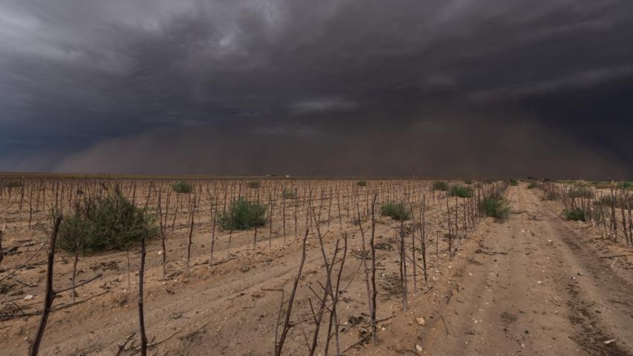
According to the agency, there are above-normal probabilities for rainfall to fall below average through mid-October, signaling an extended dry period for Deep East Texas and North Louisiana. This forecast highlights the potential for a rapid onset drought that could worsen soil moisture deficits and impact several sectors.
- Widespread dryness is expected to persist through October 17.
- Below-normal rainfall chances extend across the southern United States.
- Potential consequences include heightened agricultural stress and increased wildfire risks.
Expert Advice and Precautions
Local authorities and weather experts urge residents to take protective measures. Conservation of water and close attention to forecast updates are recommended, especially if drought conditions continue to worsen.
Read Also: Seattle Weather Forecast: Warm, Dry Conditions Expected Through Mid-October
“The lack of significant rainfall combined with rising temperatures creates conditions conducive to rapid drought development, which could have serious implications for agriculture and wildfire management,” said a spokesperson from the National Weather Service. More details can be found in their official release at Country Herald.
What This Means for Residents and Communities
The upcoming weather pattern serves as a critical reminder for communities to prepare and stay informed. The combination of heat and drought not only affects crops and natural landscapes but also places strain on water resources vital for daily use.
Key takeaways include:
- Monitor daily weather updates for any changes in drought status.
- Implement water-saving practices to reduce consumption.
- Be vigilant about fire safety in dry and hot conditions.
What do you think about this developing drought situation? Share your thoughts in the comments below and stay tuned for continued updates.