 by
by SAVANNAH, GA — A stalled frontal boundary draped across the Southeast, paired with developing areas of low pressure, is creating a recipe for several more days of heavy rainfall from the Interstate 10 corridor northward through Georgia and the Carolinas.
Forecasters warn that the pattern could lead to dangerous flash flooding, with some communities possibly seeing double-digit rainfall totals before the weekend wraps up.
Flood Watches Blanket the Region
Flood Watches remain in effect across multiple counties in Florida, Georgia, South Carolina, and North Carolina, particularly in areas already saturated from last week’s storms.
According to the National Weather Service (NWS), these watches can be upgraded to Flood Warnings if storms repeatedly move over the same locations, overwhelming drainage systems and swamping low-lying areas.
Cities in the greatest risk zone include Tallahassee and Jacksonville in Florida, Charleston and Myrtle Beach in South Carolina, and Wilmington in North Carolina.
Tropical Disturbance Being Closely Monitored
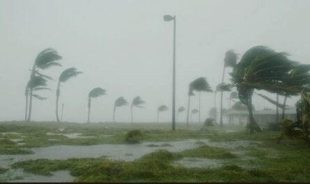
While much of the immediate focus is on heavy rain and flooding, all eyes are also on the western Atlantic Ocean, where the National Hurricane Center (NHC) is tracking a disorganized tropical disturbance.
The NHC currently gives the system a medium chance of developing into a tropical depression or storm over the next few days. A Hurricane Hunter aircraft is scheduled to investigate the area on Wednesday morning to look for signs of a low-level circulation.
As Fox Weather reported, as of midweek, rapid tropical development was not expected, but forecasters stress that even without a named storm, the Southeast will continue to see daily rounds of soaking rainfall.
Recent Flooding Adds to the Danger
Some communities are already struggling with flooded streets and water rescues. Outside Charlotte, North Carolina, an estimated 5 to 8 inches of rain fell on Tuesday, prompting emergency crews to pull stranded residents from vehicles.
In Alabama and Georgia, slow-moving thunderstorms and saturated soils have led to hazardous travel conditions and localized flash flooding in both urban and rural areas.
Read Also: California Weather: Extreme Heat Warning Issued as Wildfire Risk Intensifies
Severe Weather and Coastal Hazards
In addition to flooding, isolated severe thunderstorms remain possible through the rest of the week. Stronger storms could produce damaging wind gusts and frequent lightning. Forecasters say the slow movement of these storms will also increase the risk of high rainfall totals over a short period of time.
Coastal areas from Florida to the Carolinas will face rough surf and an elevated risk of rip currents, posing a threat to swimmers and surfers. Officials are urging beachgoers to heed all flag warnings and stay in designated lifeguarded areas.
Cooler Daytime Temperatures a Side Effect
While the rain will bring hazards, it will also keep daytime temperatures cooler than average for August. Several observation sites across the Southeast have reported near-record-low high temperatures, with many locations staying well below their normal mid-80s to low-90s readings for this time of year.
However, meteorologists caution that cloud cover and cooler temperatures do not eliminate heat risks, especially for those engaged in flood cleanup or working outdoors in humid conditions.
Safety Tips for the Days Ahead
Emergency officials urge residents to take precautions:
- Never drive through flooded roads — “Turn Around, Don’t Drown” remains the safest policy.
- Have a go-bag ready in case of evacuation orders.
- Stay informed by checking NWS alerts and local updates.
- Avoid coastal waters if rip current advisories are in place.
- Keep extra supplies in case flooding disrupts power or travel.
With the weekend forecast still showing widespread rain and possible tropical influences, forecasters stress that flooding hazards may escalate before conditions improve.
Have you experienced flooding in your area this week? Share your story, photos, or safety tips with us at ibwhsmag.com and join the conversation about how your community is preparing for the continued rain threat.