 by
by Phoenix, AZ – The National Weather Service has issued severe thunderstorm warnings, a dust storm warning, and flash flood warnings for the Maricopa and Pinal counties throughout Wednesday, September 3, 2025. Residents are urged to take immediate precautions as hazardous weather conditions unfold in the region.
The warnings indicate potentially life-threatening weather including wind gusts reaching 60 mph, heavy rains, and dangerously low visibility due to dust storms. The thunderstorm and dust storm warnings are set to last through 10 p.m., while flash flood warnings extend to 12:30 a.m.
Severity of Thunderstorm Warnings and Impact Areas
Multiple severe thunderstorms have been reported in locations across the Phoenix metropolitan area and surrounding regions. These storms are nearly stationary, raising concerns for prolonged exposure to damaging winds capable of impacting roofs, siding, and trees.
- At 9:20 p.m., a storm near Maricopa and southwest of Sun Lakes threatens highways such as State Route 238 and State Route 347, impacting communities including Estrella Sailport and Ak-Chin Village.
- Another storm at 9:07 p.m. south of South Mountain Park affects South Mountain Park, Firebird Lake, and Komatke, covering highways Interstate 10 and Loop 202.
- A severe storm over Tempe at 8:40 p.m. impacts a wide area including Phoenix, Mesa, Chandler, Gilbert, and prominent locations such as Arizona State University and Arizona Mills Mall.
- At 8:07 p.m., a storm moving north from Bapchule threatens several communities and highways, including Interstate 10 and Loop 202.
“Severe thunderstorms in the area pose risks of roof and tree damage; residents should seek interior shelter on the lowest floor,” warned the National Weather Service.
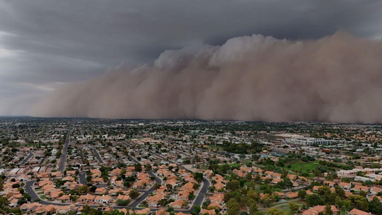
Dangerous Dust Storm Warning Disrupts Visibility
A dramatic dust storm, characterized as a haboob, moved through the region starting at 8:14 p.m., bringing visibility below a quarter mile and winds exceeding 40 mph. The wall of dust extended from near San Tan Village Mall to Chandler Fashion Center Mall and South Mountain Park, causing hazardous travel conditions along major highways such as Interstate 10 and Interstate 17.
- Impacted locations include: Phoenix, Mesa, Chandler, Gilbert, Tempe, and neighboring communities.
- Visibility reduction creates life-threatening driving hazards with near-zero sight.
The National Weather Service underscored critical driver safety: “PULL ASIDE STAY ALIVE!” Motorists are urged to avoid dust storms when possible and to pull off the road safely if caught in one.
Flash Flood Threats Across Urban and Low-Lying Areas
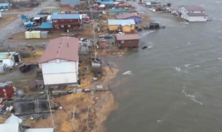
Intense thunderstorms brought between 0.5 and 1 inch of rain to the warned areas, triggering ongoing or imminent flash flooding in creeks, streams, urban zones, streets, and underpasses.
- Key locations expecting flash floods include Phoenix, Maricopa, Bapchule, Olberg, Ak-Chin Village, and Komatke.
- Additional affected sites include urban centers and shopping malls like Mesa Riverview Mall, Tempe Marketplace, and Arizona Mills Mall.
Officials warn, “Life-threatening flash flooding is ongoing or expected shortly, especially in poor drainage and low-lying areas. Exercise extreme caution.”
Understanding and Preparing for the Warnings
Severe thunderstorm warnings indicate storms with winds exceeding 58 mph or hail larger than an inch in diameter. The National Weather Service advises all residents to seek refuge inside buildings, stay clear of windows, and stay tuned to battery-powered weather radios in case of power outages.
For dust storm survival while driving, the Arizona Department of Transportation’s famed “Pull Aside, Stay Alive” campaign provides lifesaving guidance:
- Pull off the roadway promptly once visibility decreases.
- Turn off all vehicle lights to avoid other drivers using them as a visual guide.
- Set the emergency brake and remain seated with seat belts fastened until the storm passes.
Furthermore, residents should postpone any outdoor activities until weather conditions improve to ensure safety.
The Phenomenon of Haboobs in Arizona Monsoon Season
The current dust storm fits the profile of a haboob, a powerful dust storm phenomenon common during the Arizona monsoon season from June to September. These storms arise when strong winds stir loose dust into towering walls of dust and debris, severely limiting visibility.
Andrew Deemer, meteorologist with the National Weather Service in Phoenix explains, “Haboob is an Arabic term meaning ‘big, blasting winds,’ and perfectly describes the intense dust storms we experience during the monsoon season.”
Stay Informed and Safe: Continuous Updates Available
Residents are encouraged to stay updated on the evolving weather situation. Additional safety information about dust storms and monsoon driving conditions can be found at azdot.gov/monsoon.
Key Safety Recommendations:
- Seek cover immediately in a sturdy building during storms.
- Avoid driving through dust storms or flooded roads.
- Maintain a fully charged battery-powered weather radio.
- Secure outdoor objects that can become dangerous debris in high winds.
- Bring pets indoors to ensure their safety during severe weather.
What do you think about these severe weather events? Have you ever experienced a haboob or flash flood in the Phoenix area? Share your thoughts and stories in the comments below!