 by
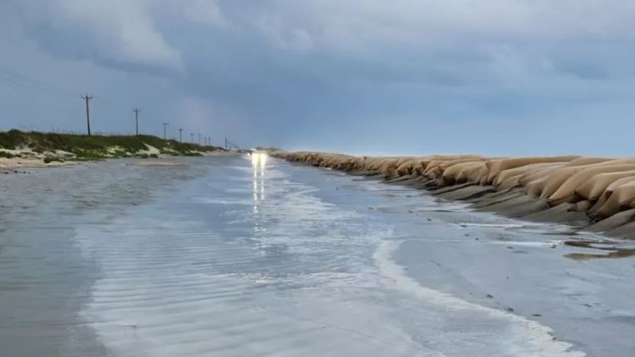
by Wilmington, N.C. – Residents along the coasts of southeast North Carolina and northeast South Carolina should brace for hazardous surf and life-threatening rip currents expected to worsen through early next week. As tropical activity increases in the Atlantic, forecasters warn of dangerous marine conditions beginning as early as Sunday night.
The National Hurricane Center is currently monitoring Tropical Storm Humberto, which is moving northwest near Bermuda, alongside a separate tropical disturbance near Hispaniola that is likely to develop into a depression before tracking toward the Bahamas. This system has the potential to shift northward, bringing impacts to the Carolinas early next week, though direct landfall remains uncertain.
Increasing Marine Hazards Along Carolinas Coast
The National Weather Service has issued strong warnings about escalating marine dangers. While specifics around wind, rain, and tornado threats are still developing, forecasters have high confidence in the forecast for dangerous rip currents and rough seas along the coastline. Areas including Myrtle Beach to Wrightsville Beach should anticipate rough surf conditions that may result in swimming area closures and hazardous boating situations.
- Hazardous surf and rip currents expected to intensify through early next week
- Swimming areas likely to close due to unsafe conditions
- Boating may become dangerous because of rough seas
- Coastal flooding and power outages possible if the system moves closer to shore
Preparation and Safety Measures Urged
Emergency officials are strongly encouraging residents in the affected areas to take necessary precautions ahead of the potential storm impacts. Key preparedness steps include:
- Reviewing detailed hurricane plans
- Charging electronic devices to remain connected during outages
- Monitoring upcoming advisories and warnings from local authorities
“Even without a direct strike, coastal flooding and power outages remain possible if the system edges closer to shore,” experts warn.
Read Also: Louisville, KY Weather Forecast: Drier, Warmer Conditions Expected Through Sunday
What to Expect in the Coming Days
The National Weather Service in Wilmington is set to provide its next detailed update by 6 a.m. Friday, with expectations to issue more advisories as the storm’s track becomes clearer. Residents should stay vigilant and prepared for possible warnings that could remain in effect into early next week.
For full details and ongoing updates on the tropical system, visit the original source.
Key Takeaways:
- Coastal areas from southeast North Carolina to northeast South Carolina face increased marine hazards.
- Tropical Storm Humberto and a developing disturbance near Hispaniola are being closely monitored.
- Life-threatening rip currents and hazardous surf are the primary concerns for the upcoming days.
- Residents should prepare early and stay informed through official weather updates.
What do you think about this weather alert? Are you prepared for potential coastal impacts? Share your thoughts and preparation tips in the comments below!